
Siguniang Mountain: A Hiking Journey at the Foot of Snow-Capped Peaks

Siguniang Mountain
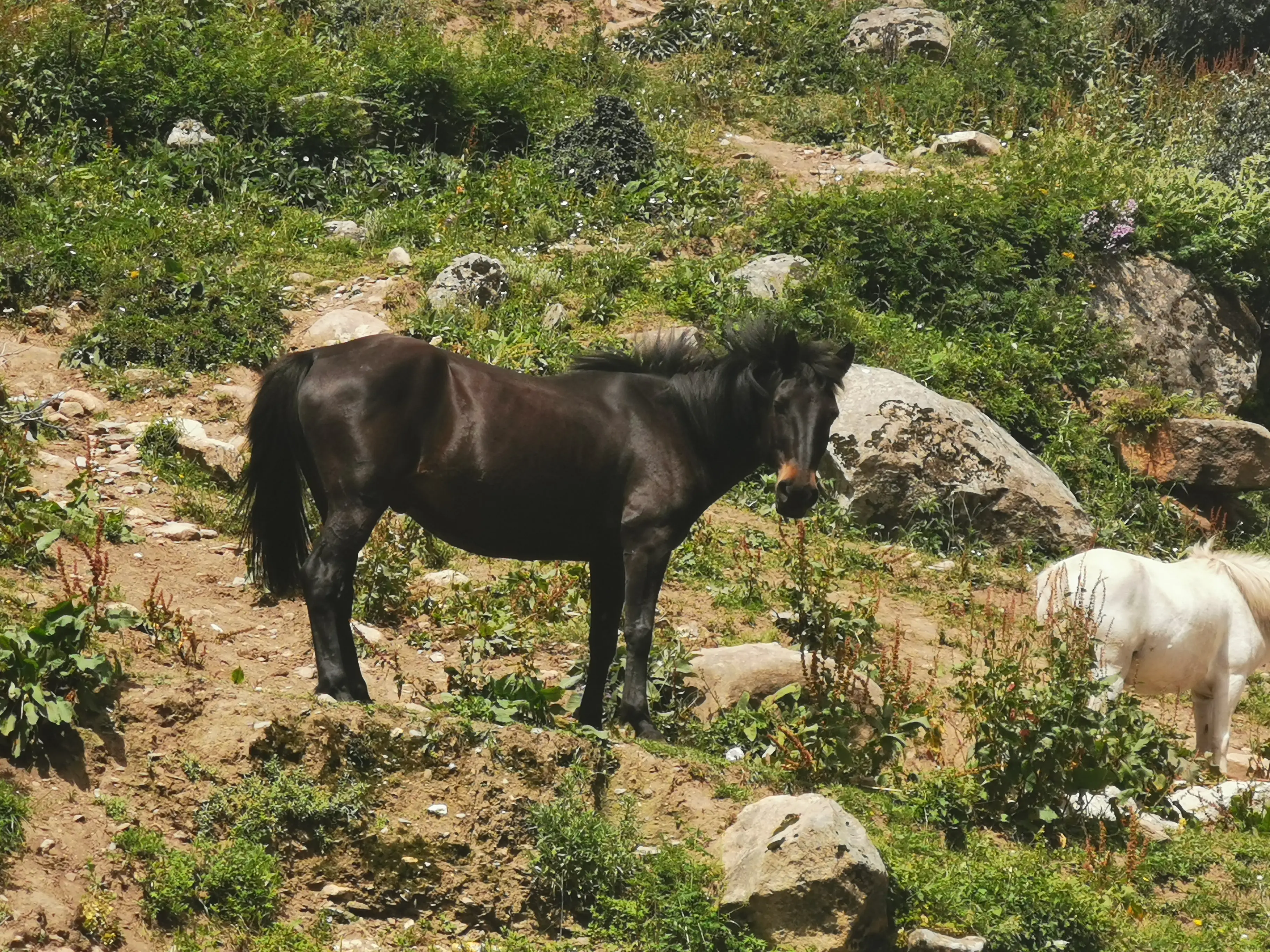
The Mountain Guardian Deity
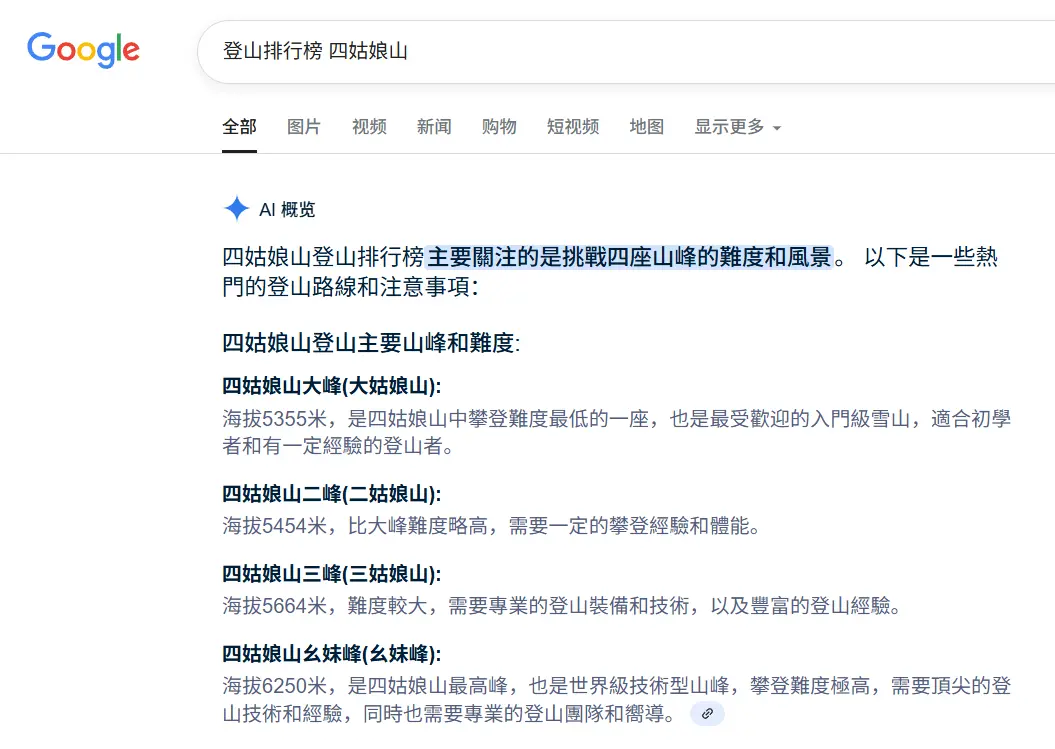
Siguniang Mountain graces western Sichuan’s landscape with four interconnected peaks. The name “Siguniang” originates from Tibetan transliteration: Standard Tibetan: སྐུ་བླ་, Romanized: Sku—Skuladur (signifying “Mountain Guardian Deity”). With four distinct peaks, local Han Chinese later misinterpreted “Sigu” as Chinese, transforming it into “Siguniang” (Four Girls Mountain)1.
From eldest sister to youngest, while familial rank diminishes, mountaineering challenges intensify. Since 1981, merely 41 individuals have conquered the youngest sister peak2. Ranking these four peaks by climbing difficulty reveals Siguniang Mountain’s progression mirrors four tiers of elite global mountaineering routes.
Route Selection
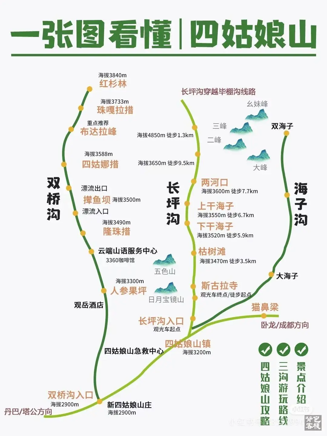
Currently, Siguniang Mountain offers three common tourist or hiking routes:
- Shuangqiao Valley: Commercial development level 90%, suitable for all ages, mainly featuring canyon rafting.
- Changping Valley: Commercial development level 50%, featuring canyons, snow mountains, and primeval forests. It’s one of China’s classic hiking routes, requiring a guide beyond the Muluozi3 scenic spot.
- Haizi Valley: Commercial development level 20%, not suitable for non-professional hiking enthusiasts.
Most people spend two days and one night. When choosing Shuangqiao Valley, you can stay inside the scenic area for an extra day.
Beyond these three routes, there’s the free Maobiliang viewpoint. Climbing up at dusk allows you to witness the “Golden Mountain Sunset”—the evening glow bathing Siguniang Mountain’s glaciers.
Each route is one-way, so you only need to manage your overall time, not consult a map.
Changping Valley
How to Explore
Accommodation outside the scenic area is typically near Siguniangshan Town (close to the visitor center).
In Siguniangshan Town, the cheapest hot meal is 15 yuan tofu rice.
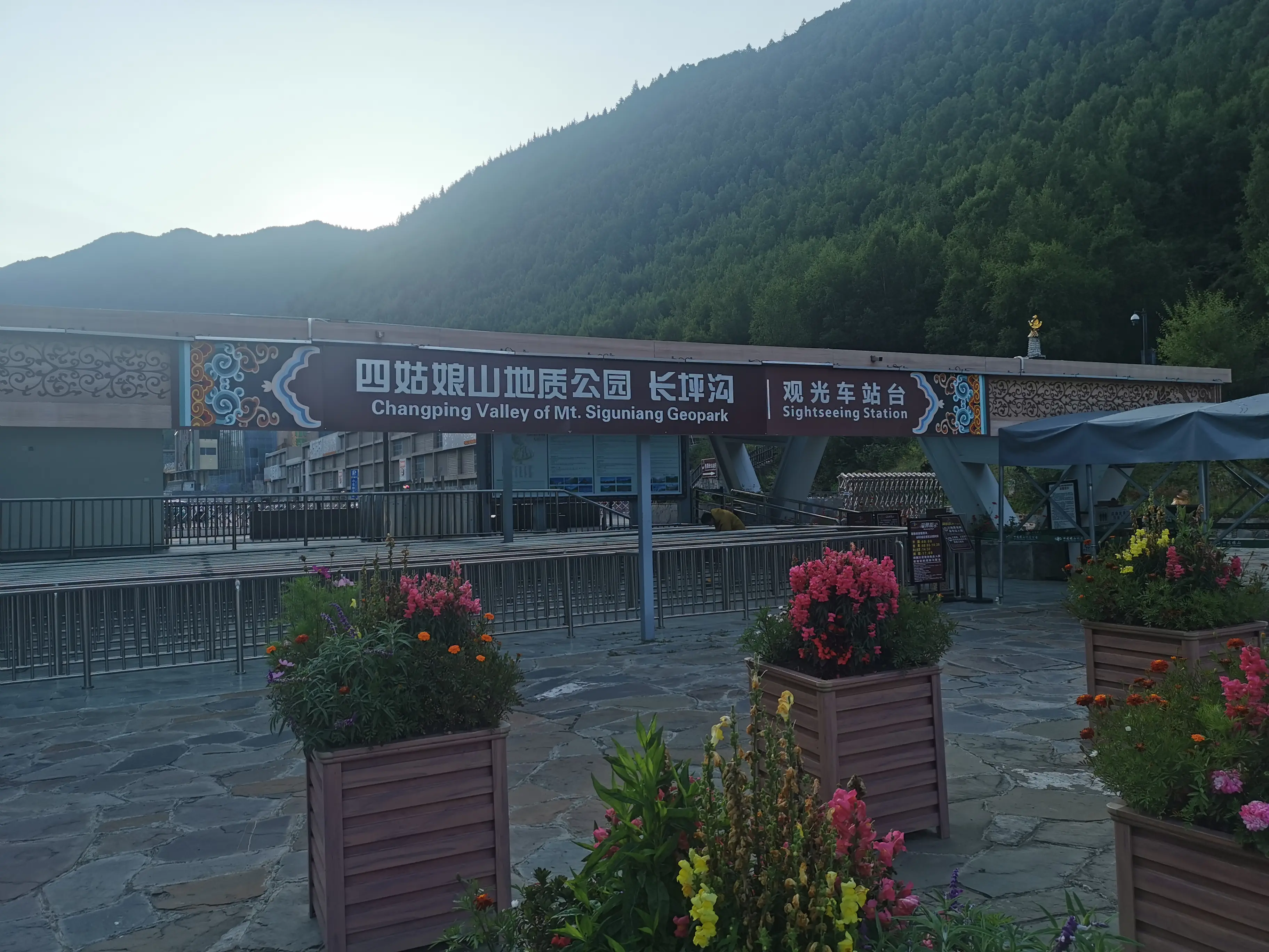
Starting at 7:40 AM, you can wait at the visitor center for the sightseeing bus, which begins circulating at 8 AM to transport visitors to the Changping Valley entrance.
- Recommended 8:00-13:00: Walk the boardwalks, savor the deep valleys and serene forests, and enjoy proper rest and viewing at the endpoint.
- Recommended 13:00-16:00: Return via the horse trails. Although you don’t need to ride horses, the horse trails are flatter and easier to walk.
My step count for the day is shown below. Looking back, this number seems quite auspicious:

Scenery
Snow-capped mountains, canyons, primeval forests
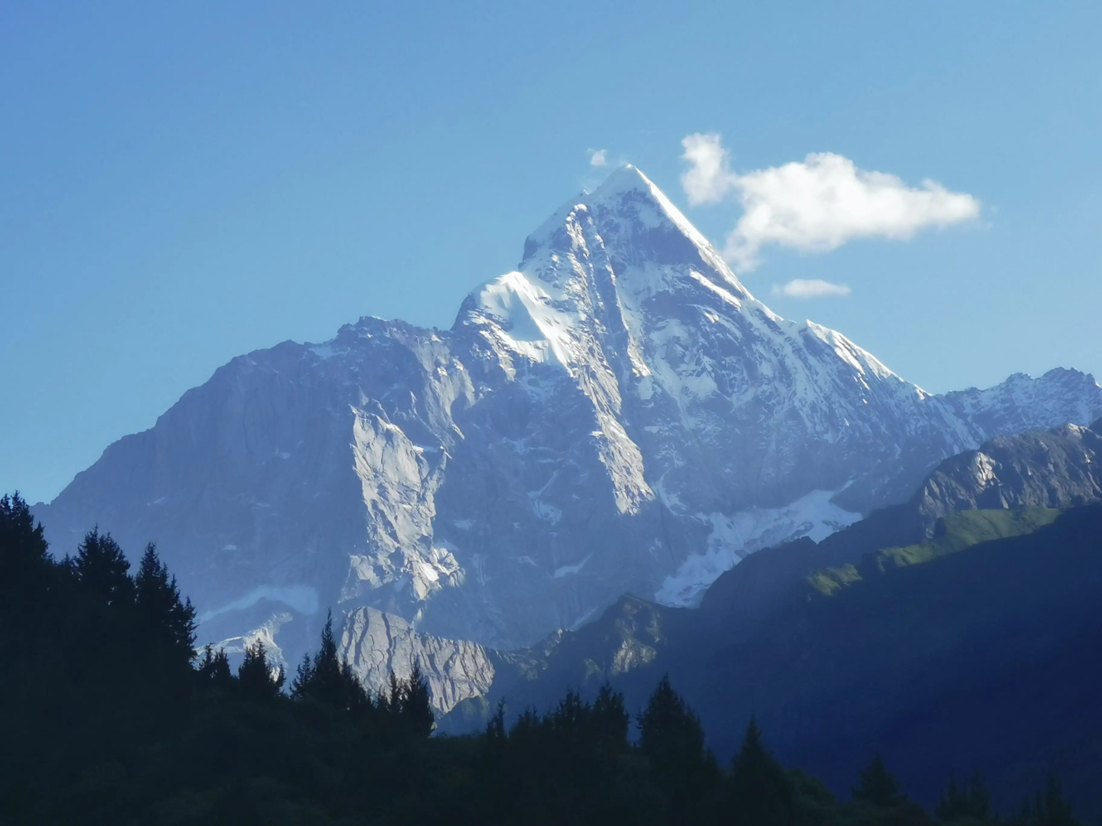
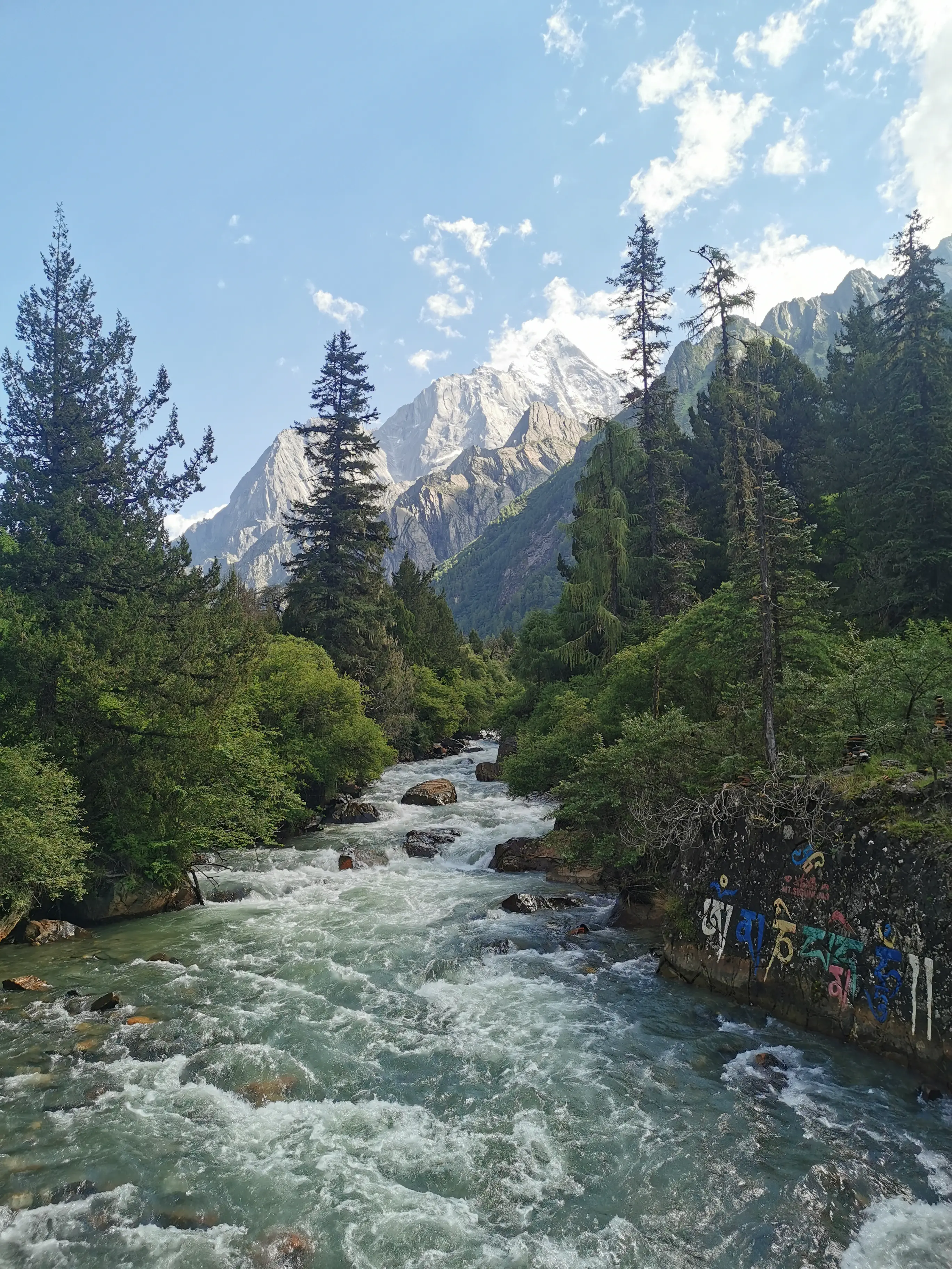
I visited during Sichuan’s warmest average temperature period, yet Siguniang Mountain’s permafrost remained steadfast. Upon entering, distant, majestic snow-capped peaks shimmer with crystalline light, while lush greenery carpets the slopes below. One can readily comprehend why this “sacred mountain” holds such profound significance for local communities.
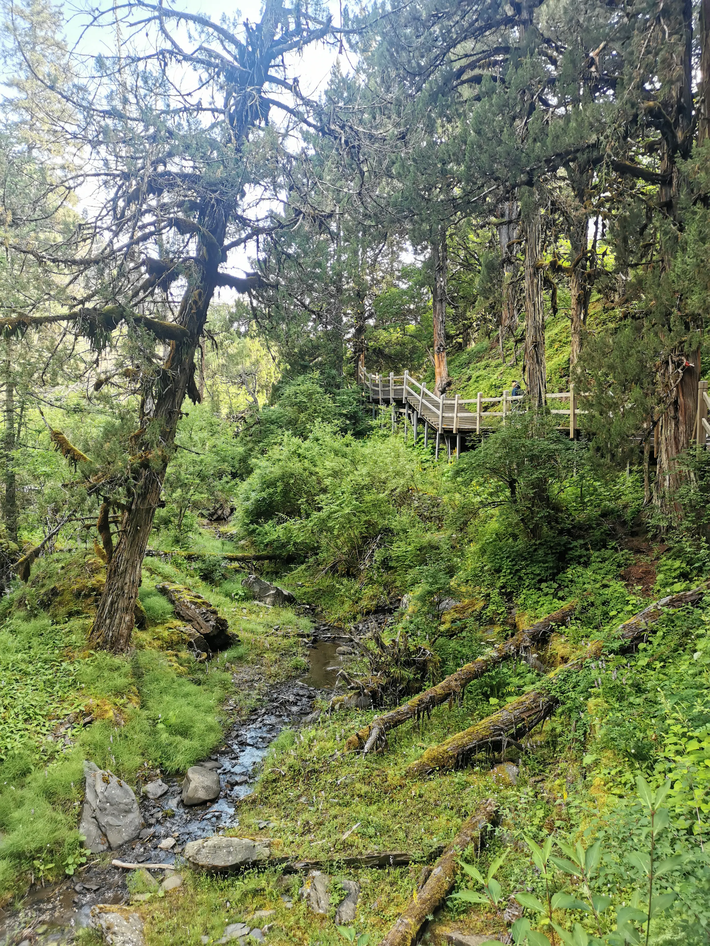
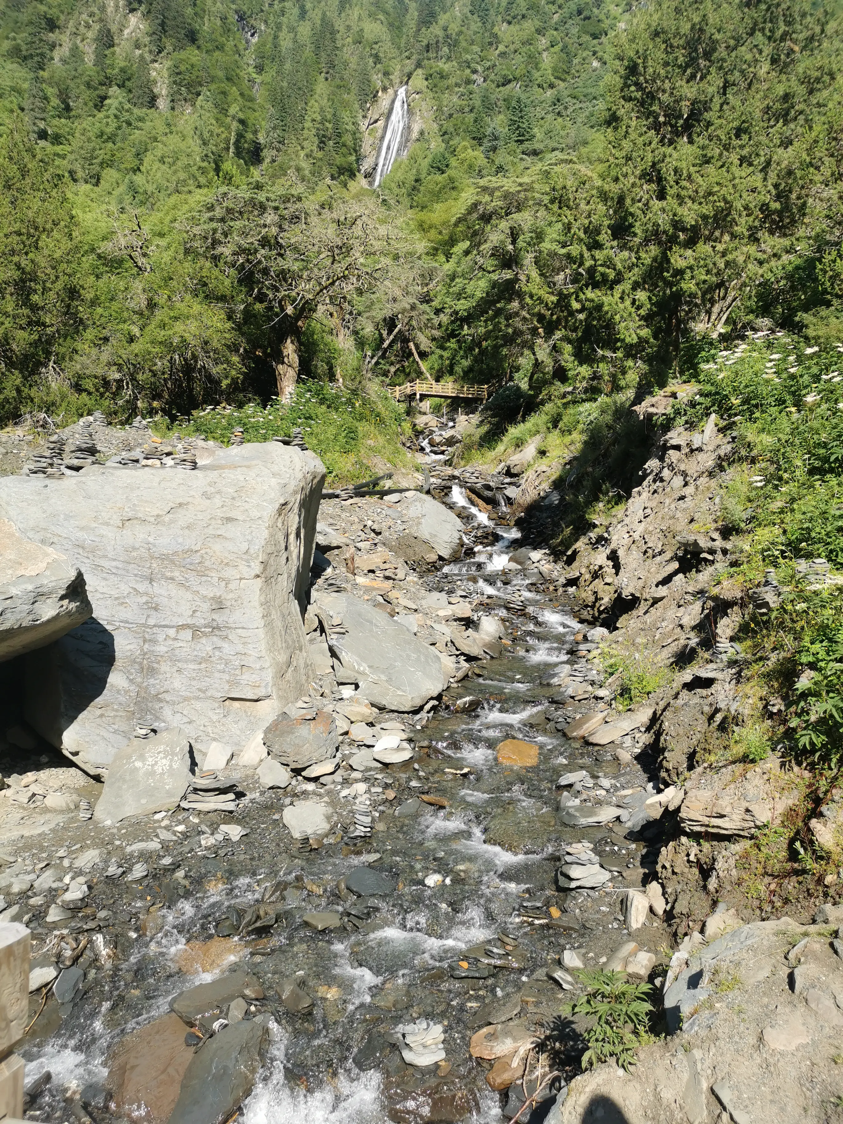
Melting snow and ice water slowly flows down, nourishing the primeval forest below. Note that you should leave the boardwalk-free primeval forest section before 3 PM and the forest section with boardwalks before 5 PM because bears are present.
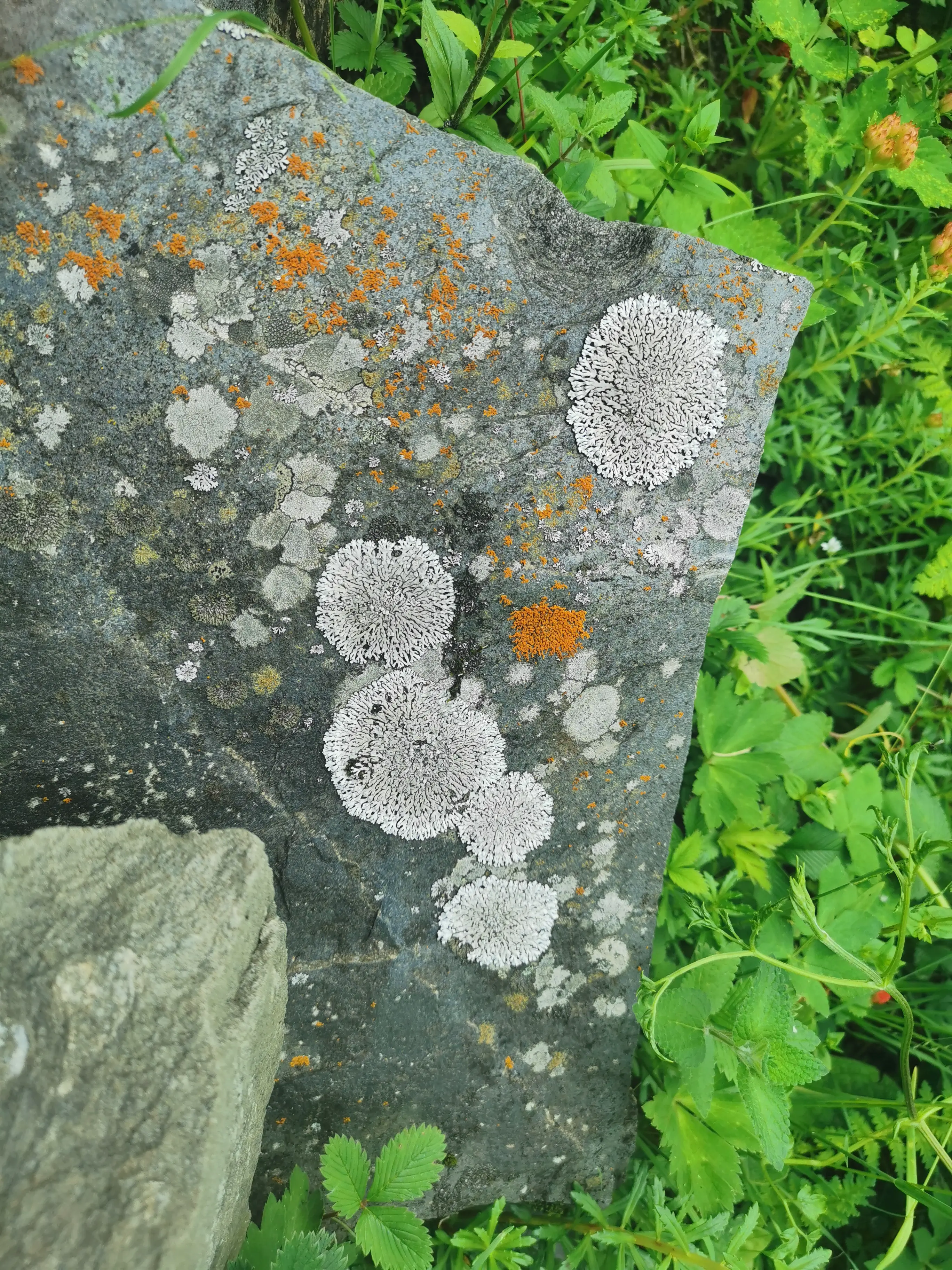
Trees lie haphazardly in piles, merging with the earth and each other through moss and lichen.
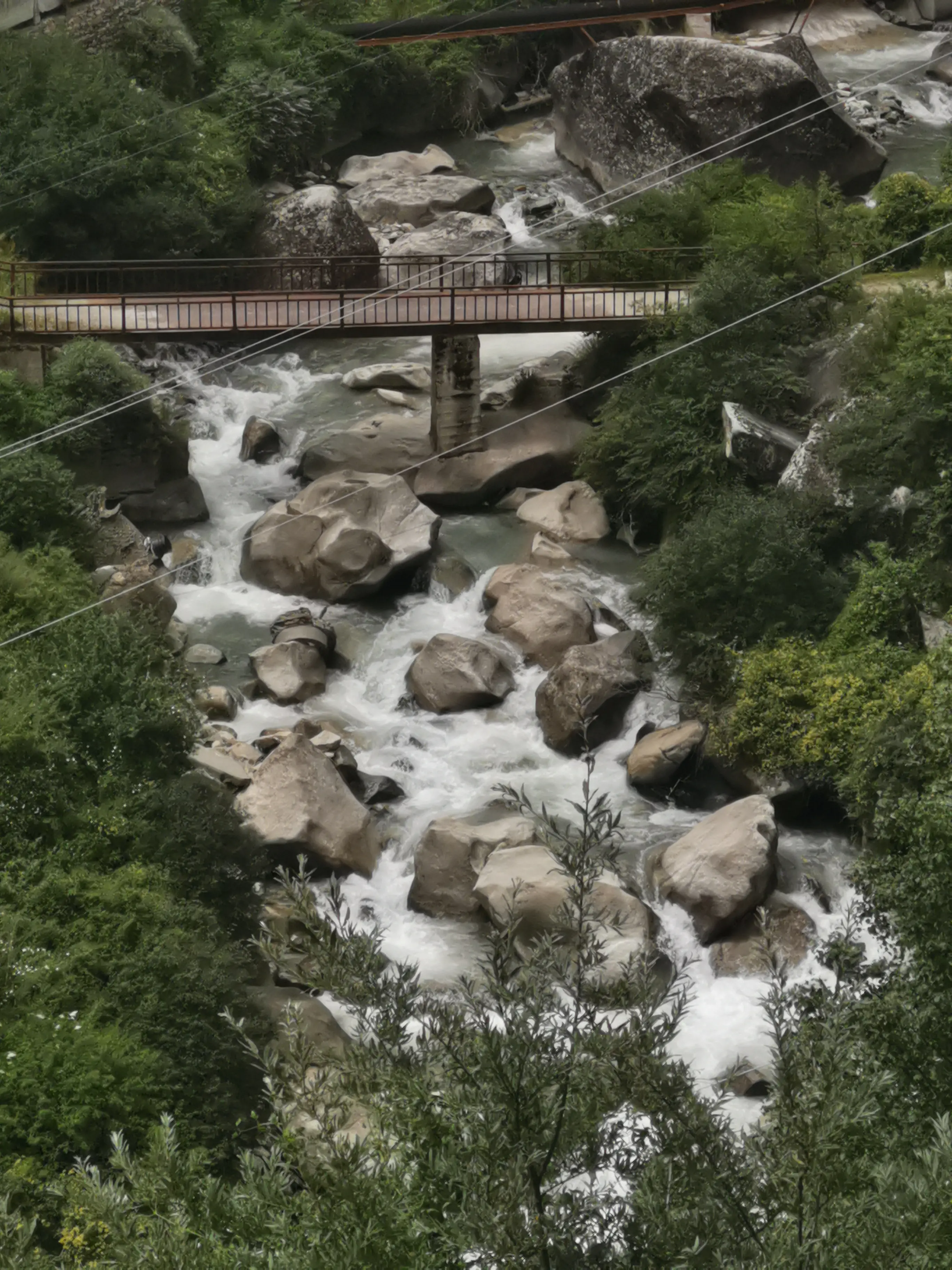
Icy meltwater from the snow mountains converges into rivers, dancing playfully through stone crevices. Clouds serve as the ever-changing skirts of the snow mountain goddess, while converging rivers form graceful emerald ribbons cascading from her hem.
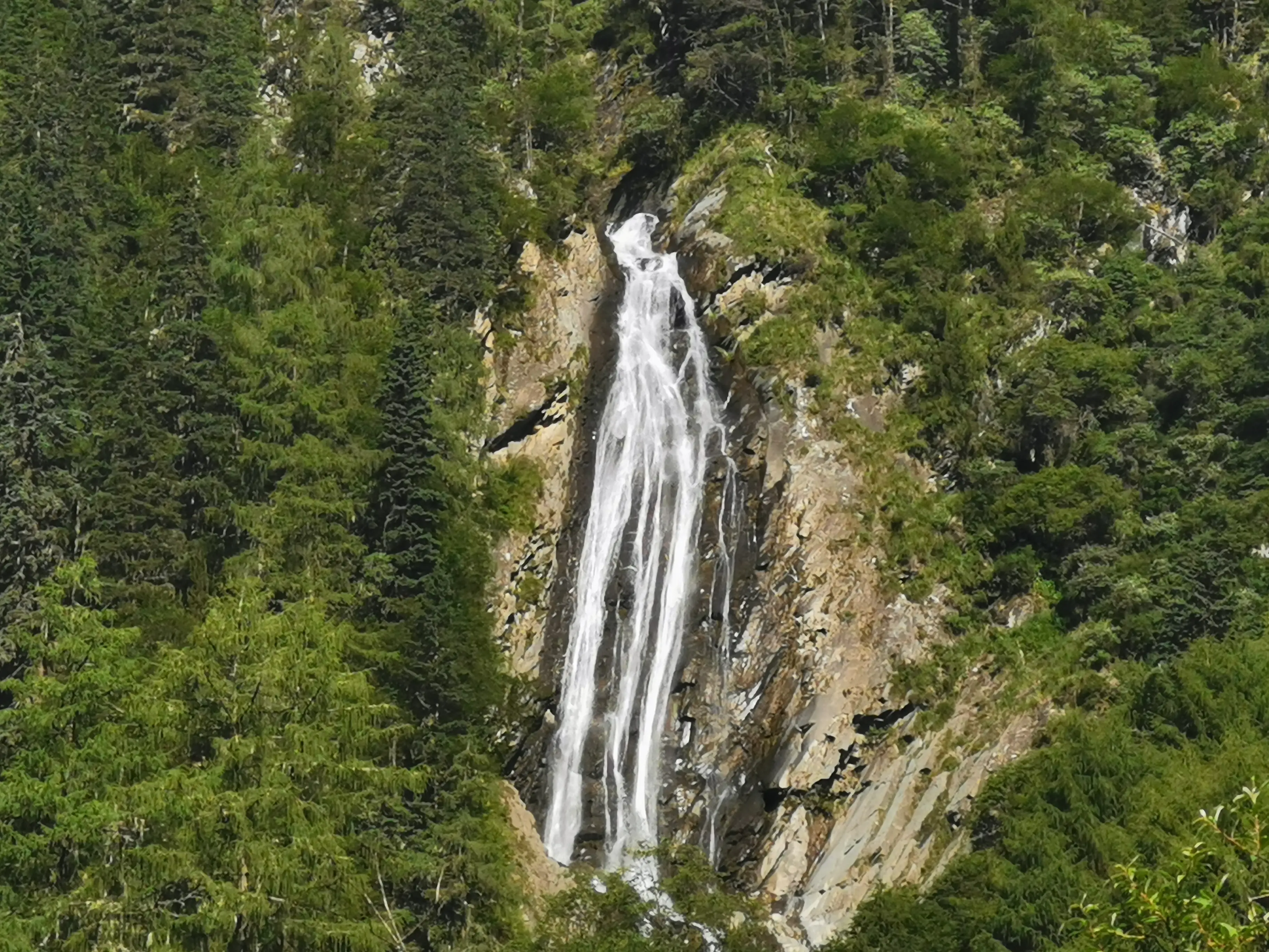
Suspended springs and waterfalls cascade between them; withered trees and rugged stones complement each other delightfully.
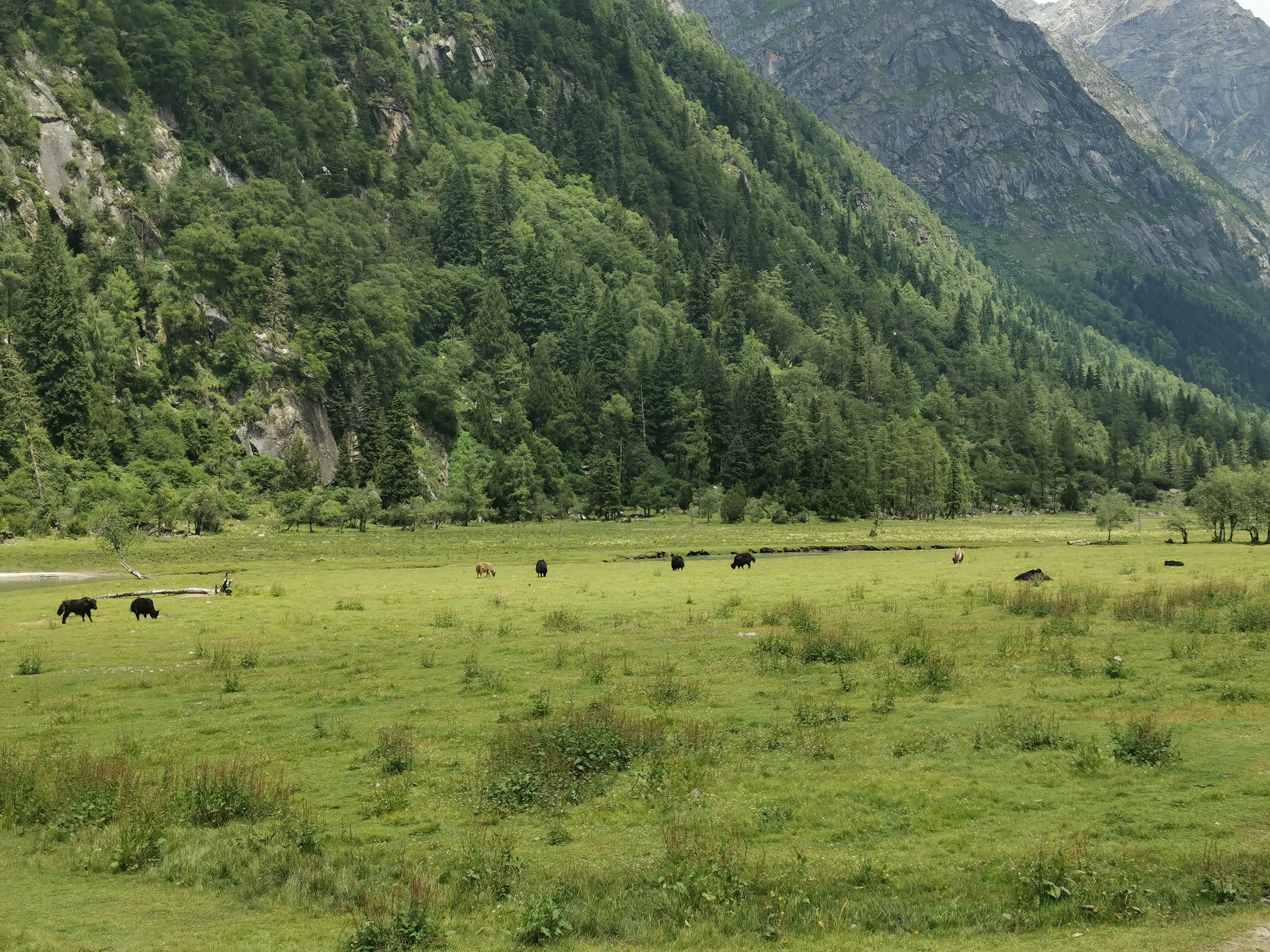
At the entrance, majestic snow-capped mountains rise before you, with lush forests carpeting the slopes beneath. Venturing along boardwalks into verdant depths, admiring crystalline streams and cascading waterfalls, you feel the snow mountains’ watchful presence as you draw nearer. As flanking mountains gradually recede and a rustic wooden gate materializes, you’ve arrived at Muluozi. Suddenly, the landscape unfolds dramatically—it’s ambiguous whether mountains pierce the heavens or skies cradle the emerald peaks. Cattle and sheep graze contentedly nearby, and the snow mountains appear more benevolent than ever.

As mountains retreat, expansive plains unfurl, with glaciers standing sentinel alongside. This landscape evokes an earthly paradise.
Experiencing this profound emotional transition—from distant snow mountains and narrow, shadowed boardwalks to snow mountains towering before you and sweeping open plains—constitutes the very soul of this hiking journey.
Important Notes
Temperature and Clothing
I visited during Sichuan’s warmest average temperature period, when Siguniang Mountain temperatures range around 14-24°C. However, temperature variations at high altitudes are more extreme—it can drop to 8°C during morning rain and rise to 26°C under afternoon sunshine. Therefore, long sleeves and pants suitable for mid-to-late autumn are recommended for versatility.
For a two-day, one-night trip, no special sun protection is needed—just a hat will suffice. To combat low blood sugar, consider bringing a bottle of cola to drink along the way.
For a day trip covering approximately 15 kilometers round trip, proper hiking shoes are highly recommended.
Air Pressure and Altitude Sickness
Personally, I didn’t purchase any oxygen bottles or take any related medications. While running and hurrying didn’t cause specific discomfort, I still experienced some reactions:
Reference Huawei smartwatch data (values for reference only):
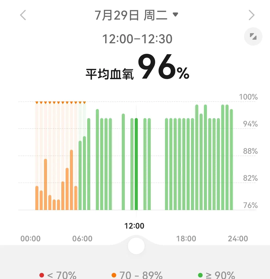
My usual awake blood oxygen level is around 99%, with sleep blood oxygen around 96%. After ascending the mountain, my awake blood oxygen dropped to around 96%, with sleep blood oxygen around 86%.
The yellow section in the image shows my sleep situation on the mountain. Upon waking, I indeed felt some chest pressure. After descending at 10 PM, my awake blood oxygen returned from 96% to 99%.
Budget
- Round-trip transportation from Chengdu: relatively inexpensive options around 120 yuan.
- Scenic area ticket (includes shuttle bus from visitor center to scenic area): 90 yuan.
- Cheapest accommodation: 60 yuan per night.
- Food: Personally chose two 20-yuan yak beef noodle soups + bread + found a 65-yuan double meal set in Siguniangshan Town.
You can basically stay within 400 yuan. Adding some food purchases along the way, staying under 500 yuan is more than sufficient.
Weather and Lighting
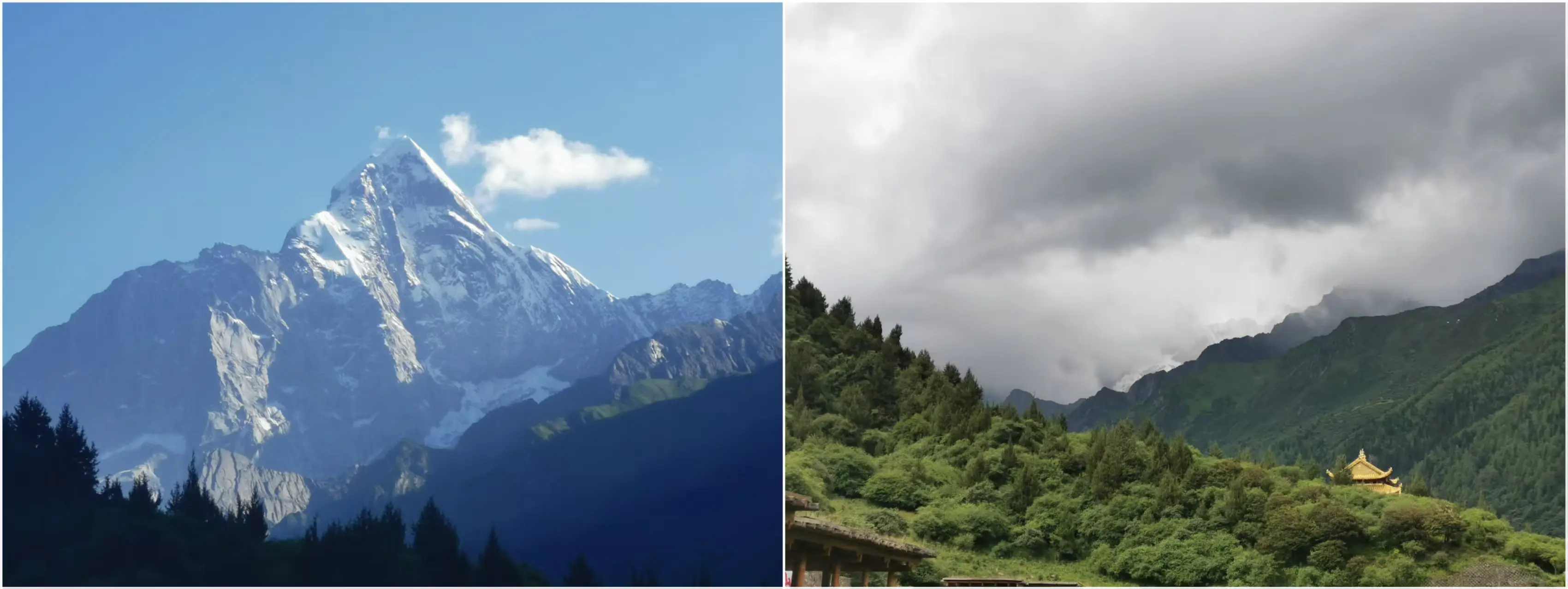
Since snow mountain vistas constitute this hiking route’s primary allure, overcast or rainy conditions can diminish your experience’s value by half while significantly elevating risk factors.
I was fortunate—during my ascent, glorious sunshine prevailed, with rain commencing only toward my journey’s conclusion.
- The left image below shows the clear morning weather with snow mountains clearly visible.
- The right image shows the same location during my return, where distant snow mountains were completely obscured by clouds and mist.
During our return, there were three road landslides along the route (cleared by the time we passed) and one traffic accident.
As shown in the images, we had perfect sunny weather during our ascent with snow mountains visible throughout, but rain began during our return, completely burying the snow mountains in dark clouds.
-
Only 41 successful summits in 40 years: Revealing why Siguniang Mountain’s youngest sister peak is “difficult to climb” ↩︎
-
For amateur hikers and ordinary tourists, Muluozi is the endpoint ↩︎